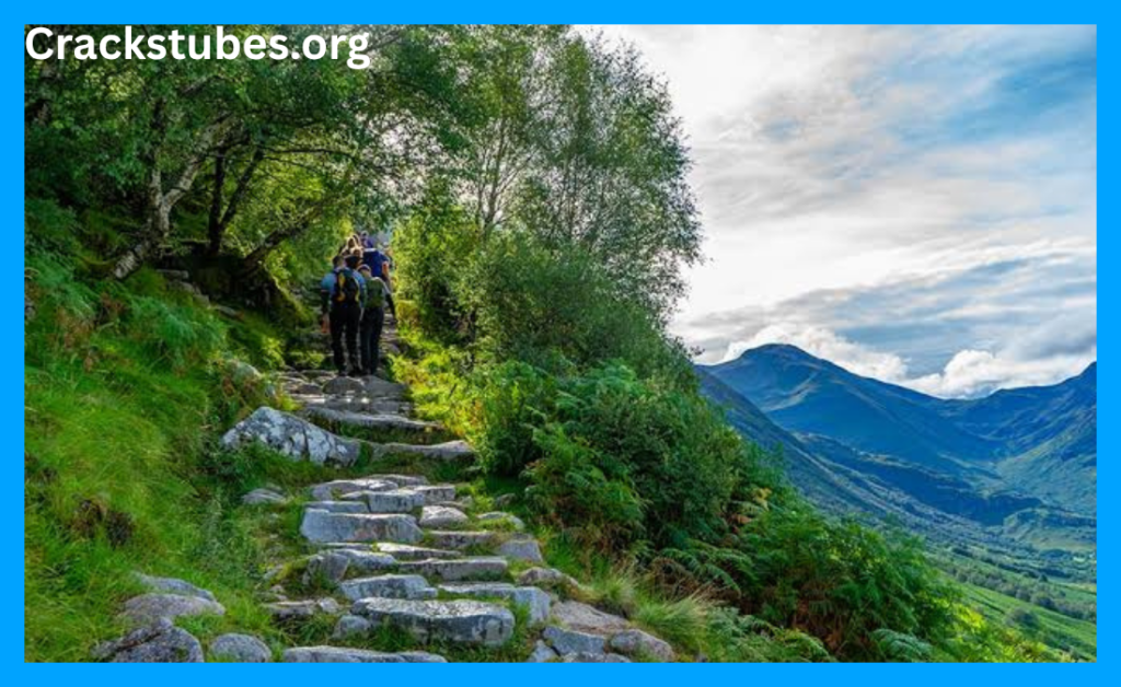
Ben Nevis rises to 1,345 metres above sea level, making it the highest mountain in Scotland and the highest point in the British Isles. But its real story is not simply about height: the summit once housed a working weather observatory, and its mountain track was originally built for access to it.
The fact that settles the first question
There is no mystery about Ben Nevis’s status. At 1,345 metres, it stands above every other mountain in Britain. The National Trust for Scotland describes it as Scotland’s tallest mountain and part of the Grampian range, near Fort William in Lochaber.
The mountain is also a Munro. In Scottish mountaineering, a Munro is a mountain higher than 3,000 feet, or 914 metres. Ben Nevis comfortably exceeds that threshold.
Its Gaelic name is Beinn Nibheis. The exact meaning is less certain than its height. One commonly cited interpretation connects the name with words meaning “malicious” or “venomous”, while another interpretation links it to the idea of a mountain with its head in the clouds. No single translation should be presented as definitively settled.
Ben Nevis was once a place of scientific work
The most surprising part of the mountain’s history sits near the summit.
In the late 19th century, scientists became interested in recording weather conditions at high altitude. Ben Nevis was particularly useful because of its western Scottish position and exposure to Atlantic weather systems.
In 1881, meteorologist Clement Wragge made daily summer ascents of the mountain to collect observations. According to the historical record maintained by Ben-Nevis.com, he usually began his climb around 5 a.m. and continued the work through the summer.
That experiment helped lead to something more permanent.
The observatory opened in 1883
A public appeal in 1883 raised enough money to construct both an access route and a summit observatory. The observatory officially opened in October that year.
Regular observations began in November 1883 and continued until the observatory closed in 1904. The surviving records provide an unusually detailed picture of conditions on the summit during those two decades.
The environment was far from comfortable.
Heavy snow could cover the building, sometimes making access to the instruments impossible. A 30-foot tower was eventually added so observers could reach the building through deep winter snow.
The observatory’s closure was connected to inadequate government funding. It eventually fell into disrepair, and a fire in 1932 caused further damage to the remains.
The famous “Tourist Path” has a very practical origin
Another commonly misunderstood part of Ben Nevis history is its main walking route.
Today’s route is generally known as the Mountain Track, although many people still call it the Tourist Path. It was originally constructed in 1883 as an access route for the summit observatory. Historical records also refer to it as the Pony Track because ponies were used to carry supplies.
That explains why the route became so important to early visitors. It was not originally designed simply as a recreational hiking trail.
Today, the National Trust for Scotland warns that reaching the summit still requires proper mountain preparation, navigation skills and fitness. The mountain’s height should not be mistaken for an easy walk.
The mountain is much older than its famous history
Ben Nevis’s story begins long before Victorian explorers.
The Geological Society explains that the granite associated with Ben Nevis formed from magma intruded deep beneath an active volcano around 350 million years ago. The rock has resisted erosion particularly well, helping leave behind the dramatic mountain landscape visible today.
So the summit visitors see today is effectively the exposed remains of an ancient geological story.
That makes the mountain unusual in another way. Its modern identity as a hiking destination represents only the latest chapter in a landscape shaped over hundreds of millions of years.
Why is the weather such a major part of the story?
Ben Nevis’s location and elevation produce difficult conditions.
Historical observatory records show that cloud was present around the summit for a large proportion of the year. The mountain can experience strong winds, heavy precipitation, freezing temperatures and snow even when conditions lower down appear relatively mild.
This is why photographs showing clear blue skies can give a misleading impression of what a climb involves.
A sunny morning in Fort William does not guarantee similar conditions near the summit.
What remains unconfirmed?
There are plenty of dramatic stories surrounding Ben Nevis, particularly about extreme weather, historic climbers and unusual incidents.
But individual claims should be treated carefully. A story repeated on hiking forums or social media is not automatically a documented historical fact. Unless an incident can be traced to reliable records, official documentation or a reputable historical source, it is safer to describe it as unverified rather than established.
The facts that can be confirmed are already remarkable: Britain’s highest mountain, a Victorian observatory, a historic pony track and a geological history stretching back hundreds of millions of years.
The mystery is ultimately simpler than it appears
Ben Nevis does not need an invented legend to make it extraordinary.
Its height is confirmed. Its observatory existed. Its Mountain Track has a documented Victorian purpose. And its granite foundations tell a geological story that began millions of years before the first recorded climbers arrived.
The mountain’s most revealing secret is therefore not hidden at the summit. It is in the layers of history beneath it.
Author bio:
Headline Magazine Editorial Team — covering British landmarks, travel history and human-interest stories with a focus on documented facts, historical context and source-based reporting.